Property Record
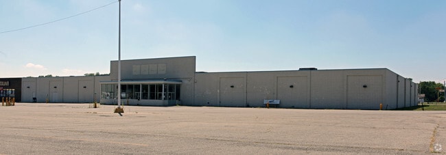
460 W Main St, New Lebanon, OH 45345


NEARBY LISTINGS FOR SALE OR LEASE
-
-
View all New Lebanon listings for sale on LoopNet.com
Property Detail
460 W Main St
F24-00210-0045
4-4-2 2-10-52, 63
Religious
Montgomery
X
Ohio
39113C0207E
45
2024
4 AC
2025
West Dayton
150100
Cincinnati/Dayton
53,844 SF
Dayton, OH
DEMOGRAPHICS near 460 W Main St
1 Mile
3 Mile
5 Mile
2024 Total Population
3,608
6,170
10,472
2029 Population
3,532
6,020
10,174
Pop Growth 2024-2029
(2.11%)
(2.43%)
(2.85%)
Average Age
41
42
42
2024 Total Households
1,457
2,505
4,227
HH Growth 2024-2029
(2.26%)
(2.51%)
(2.91%)
Median Household Inc
$55,506
$60,389
$64,393
Avg Household Size
2.40
2.40
2.40
2024 Avg HH Vehicles
2.00
2.00
2.00
Median Home Value
$124,438
$147,142
$170,146
Median Year Built
1964
1965
1965
Nearby Places
Map Layers
Map Styles
 Street
 Aerial
- Restaurants
- Banks
- Shops
- Fitness
- Groceries
PUBLIC TRANSPORTATION
AIRPORT
James M Cox Dayton International
DRIVE
WALK
Distance
James M Cox Dayton International
32 min
19.7 mi
Freight Ports
Port of Toledo
DRIVE
WALK
Distance
Port of Toledo
193 min
164.8 mi
Nearby Properties
Address
Land Use
TOTAL SIZE
Lot Size
Zoning
Address
Land Use
TOTAL SIZE
Lot Size
Zoning
45.09 AC
Address
Land Use
TOTAL SIZE
Lot Size
Zoning
18,900 SF
14.66 AC
Address
Land Use
TOTAL SIZE
Lot Size
Zoning
Address
Land Use
TOTAL SIZE
Lot Size
Zoning
42,493 SF
3 AC
Address
Land Use
TOTAL SIZE
Lot Size
Zoning
1.65 AC
Address
Land Use
TOTAL SIZE
Lot Size
Zoning
5.56 AC
Address
Land Use
TOTAL SIZE
Lot Size
Zoning
51,700 SF
5.58 AC
Address
Land Use
TOTAL SIZE
Lot Size
Zoning
Address
Land Use
TOTAL SIZE
Lot Size
Zoning
8.40 AC
Address
Land Use
TOTAL SIZE
Lot Size
Zoning
Address
Land Use
TOTAL SIZE
Lot Size
Zoning
1,689 SF
3.29 AC
Address
Land Use
TOTAL SIZE
Lot Size
Zoning
1,537 SF
1.72 AC
Address
Land Use
TOTAL SIZE
Lot Size
Zoning
7,660 SF
5.16 AC
Address
Land Use
TOTAL SIZE
Lot Size
Zoning
4,459 SF
126.92 AC
Address
Land Use
TOTAL SIZE
Lot Size
Zoning
10,780 SF
1.48 AC
Address
Land Use
TOTAL SIZE
Lot Size
Zoning
5,300 SF
93.31 AC
Address
Land Use
TOTAL SIZE
Lot Size
Zoning
113.63 AC
Address
Land Use
TOTAL SIZE
Lot Size
Zoning
22,225 SF
3.57 AC
Address
Land Use
TOTAL SIZE
Lot Size
Zoning
0.54 AC
Address
Land Use
TOTAL SIZE
Lot Size
Zoning
10,580 SF
1.21 AC
Address
Land Use
TOTAL SIZE
Lot Size
Zoning
9,000 SF
1.38 AC
Address
Land Use
TOTAL SIZE
Lot Size
Zoning
Address
Land Use
TOTAL SIZE
Lot Size
Zoning
2,532 SF
77.71 AC
Address
Land Use
TOTAL SIZE
Lot Size
Zoning
5,554 SF
5 AC
Address
Land Use
TOTAL SIZE
Lot Size
Zoning
2,188 SF
70 AC
Address
Land Use
TOTAL SIZE
Lot Size
Zoning
5,150 SF
86.81 AC
Address
Land Use
TOTAL SIZE
Lot Size
Zoning
Address
Land Use
TOTAL SIZE
Lot Size
Zoning
3,640 SF
0.76 AC
Address
Land Use
TOTAL SIZE
Lot Size
Zoning
3,088 SF
126.29 AC
The World's #1 Commercial Real Estate Marketplace
Connect with us
© 2026 CoStar Group
The information above has been obtained from sources believed reliable. While we do not doubt its accuracy we have not verified it and make no guarantee, warranty or representation about it. It is your responsibility to independently confirm its accuracy and completeness. Any projections, opinions, assumptions, or estimates used are for example only and do not represent the current or future performance of the property. The value of this transaction to you depends on tax and other factors which should be evaluated by your tax, financial, and legal advisors. You and your advisors should conduct a careful, independent investigation of the property to determine to your satisfaction the suitability of the property for your needs.